Looking for a tool to create a map? Share geographic data online? Develop a map-based website? Perform spatial analysis? Geocode addresses? If so, give ArcGIS Online a try.
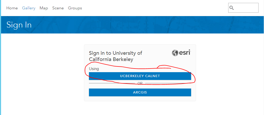
UC Berkeley students, faculty, staff and affiliates with an active Calnet ID have access to the universities ArcGIS Online enterprise account. You can access this account directly by going to cal.maps.arcgis.com. For full functionality at no cost be sure to sign in using UC Berkeley CALNET. If you have an Arcgis Online account do not use it as this will not provide you with the benefits of the UCB enterprise account (free stuff).
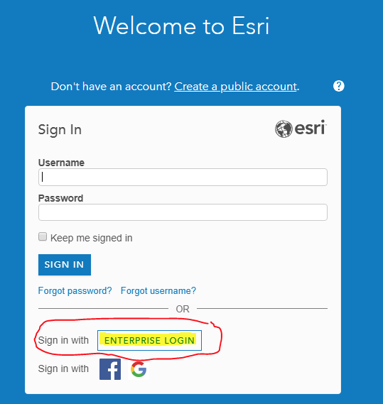
If you access ArcGIS Online directly via arcgis.com, be sure to click on that Enterprise Login Link - don’t create a new public account:
Then, when prompted, enter cal.maps.arcgis.com as the organizational URL:

If you are an ArcMap or ArcGIS Pro user you can also login to the UC Berkeley ArcGIS Online account. Again, keep looking for the link for an ENTERPRISE LOGIN:

UCB folks who use their calnet id to access the Esri World Geocoding service or ArcGIS online have an Esri credit limit of 5,000 credits/year. These credits are consumed by web mapping, spatial analysis, geocoding and other uses of Esri online services. You can request more credits from your department's ESRI system administrator if you hit your limit, but you will likely have more than you need. If you want to learn more about ArcGIS Online, check out the ArcGIS Lesson Gallery and filter by product ArcGIS Online:

You can also join us on Friday, November 9 from 11am - 1pm in room 356 Barrows for a D-Lab Workshop on ArcGIS Online. Click here to learn more and register. Happy mapping!
Author: