The New Geography of Poverty & Migration
Poverty, immigration and service provision are dynamic spatial phenomena. Historically, immigration and poverty were characteristics of big cities. But now we are witnessing a “new geography” of poverty and immigration in the United States. American suburbs are increasingly diverse, with respect to both residents’ socio-economic and immigration backgrounds. But this shift in geographic patterns of immigration and poverty has not been followed by a parallel shift in the location of non-profit social service providers or community-based organizations.
Research by Els de Graauw, Shannon Gleeson and the Berkeley Interdisciplinary Migration Initiative (BIMI) Faculty Director Irene Bloemraad, “Funding Immigrant Organizations: Suburban Free Riding and Local Civic Presence,” documents a spatial mismatch in local governments’ allocation of federal Community Development Block Grant funds (CDBG grants). The failure to give money to immigrant organizations is especially striking given that Community Development grants are supposed to make a special effort to help people in disadvantaged households.
The lack of support for immigrant-oriented social service nonprofits and community organizations carries serious consequences for the well-being of immigrant families. Since the 1960s, American social policy has shifted to a model of public-private partnerships where government funding finances local nonprofit organizations to provide services to the disadvantaged. Today, various scholars argue that nonprofits, due to their localized service functions, are uniquely situated to understand and advocate for vulnerable populations (de Graauw, 2016). Without organizations located in close proximity to growing immigrant populations, newcomers and their families risk greater food insecurity, limited access to health care or legal services, and fewer opportunities to have a voice in their communities (Bloemraad and Terriquez, 2016).
Mapping Spatial Inequality
We identify three related problems. First, there is a lack of knowledge among local official about local demographics and immigrants’ social needs. Second, immigrants often have a hard time identifying resources and services in their neighborhood. Language and cultural barriers can further decrease service-seeking. These two problems result in a third problem, a mismatch in the location of funding and services on the one hand and the needs of immigrant populations on the other hand. D-Lab is working together with BIMI to challenge these three related issues.
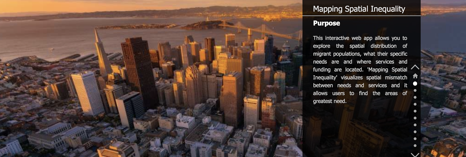
D-Lab and BIMI are developing an interactive web map which visualizes the spatial mismatch between immigrant populations’ needs and where available services and funding are located (see fig. 1 and 2 for mock-ups of this web map). This map will enable users to spatially, temporally and thematically visualize the (mis)match between resources and immigrants’ needs in the Bay Area. The core of the web app will be an interactive spatial map, integrating a unique combination of quantitative, qualitative and spatial data. With help of seed funding from CITRIS and the Banatao Institute at the University of California, D-Lab and BIMI aim to reduce the lack of knowledge about localized immigrants’ needs, improve the access to information about local services directed at immigrants and reduce the spatial mismatch between immigrants’ needs and where services are provided.
Figure 1. Mock-up of the Mapping Spatial Inequality interactive web app